PostGIS monitoring no one else offers
Spatial data inventory, index health, geometry validity checks, and query performance tracking — purpose-built for PostGIS workloads.
PostGIS powers critical geospatial applications but no monitoring tool covers it. Invalid geometries, missing spatial indexes, and SRID mismatches go undetected. We fix that.
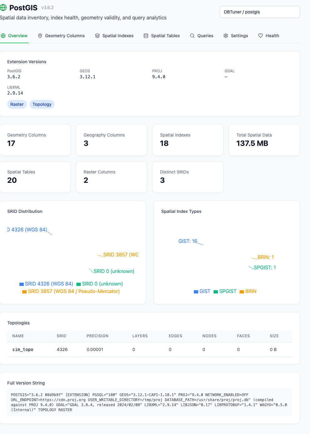
Spatial data inventory
Every geometry and geography column across your databases — coordinate type, SRID, dimensions, and storage size. One view of all your spatial data.
Spatial index health
GiST and SP-GiST index inventory with size tracking, scan counts, cache hit ratios, and build progress monitoring for long-running index creation.
Spatial table analysis
Table-level breakdown of spatial data: total size, TOAST usage, dead tuple ratios, and live tuple counts. Spot bloated spatial tables instantly.
Raster & topology
Raster column inventory and topology metadata. Track raster band counts, pixel types, and topology layers, edges, nodes, and faces.
Geometry validity checks
7 dedicated health checks covering invalid geometries, missing spatial indexes, SRID mismatches, unindexed columns, and more — with fix scripts.
PostGIS health scoring
Dedicated health check domain for PostGIS with automated checks, priority-ranked findings, and remediation scripts — just like every other part of your database.
Related capabilities
Health Scoring
75+ automated checks across 12 scoring domains
Cluster-Aware Index Advisor
Index analysis across primaries and replicas
EXPLAIN Plan Advisor
Visual plan analysis, guided walkthroughs, and regression detection
XID Wraparound Protection
Blocker detection, recovery scripts, and runbooks
TimescaleDB Monitoring
The most complete TimescaleDB monitoring anywhere
pgvector Monitoring
First-class pgvector index and query monitoring
Incident Analysis
Manual incident reports with evidence, root cause, timeline, and remediation
Phantom Incidents
Always-on anomaly detection for problems you haven't thought to alert on
Query Tuning
Highest-impact queries, the best tuning candidates, and exactly what to do
Optional AI Analysis
Manual AI depth for incidents, query plans, tuning, and explanations
Data Collection Options
Shared managed, dedicated managed, or self-hosted collectors
Smart Alerting
Rate-of-change, compound conditions, and 11 prebuilt templates
Logical Replication
Slot, subscription, apply lag, and PG17 conflict monitoring
Setup Assistant
Extension detection, auto-install, and provider-specific guides
Collaborative Playbooks
Shared remediation plans with review workflow
Trend Insights
Priority trend analyzers with severity cards and sparklines
See it in action
Start free with one primary or standalone PostgreSQL instance and all its databases. Monitoring, alerts, query insights, index advice, team access and every non-AI feature included. No replicas. No credit card required. New Free connections get seven days of full collection, then reduced sampling. Free and Pro include 30 days of monitoring history.